Directional Drilling in Greater Richmond
The only East Coast capital with whitewater downtown — because the fall line runs straight through it, granite on one bank of the metro and marine marls on the other. Richmond HDD is two-ground drilling on Virginia's one-of-a-kind permit map — and it's ours.
HDD is the whole job here
Richmond is built where the James drops off the piedmont — the fall line, announced by Class IV rapids in the middle of a state capital — and the drop is the metro's geology lesson in plain sight. West of it, the ground is piedmont: granite and gneiss weathering upward into saprolite, that crumbly rotten-rock transition that drills deceptively until a fresh core of the real thing appears; the river district's granite built half the old city. East of it, the coastal plain takes over: marine sands, clays, and the shell-rich marl beds an ancient ocean left behind — soft-country drilling with fossils in the returns. Two-ground quoting isn't a flourish here; it's the difference between a Goochland bore and a New Kent bore wearing the same brand.
Virginia then adds a permit map found nowhere else: independent cities. Richmond, Petersburg, Colonial Heights, and Hopewell sit inside no county at all — city streets run on city permits, full stop — while in the counties, VDOT maintains nearly every public road, making the state's land-use permit the default paper for what other states would call county crossings. Knowing whether an address is city or county isn't trivia in this metro; it names the permit authority outright, and our scoping starts there.
The demand map is compounding: Henrico's data-center corridor around White Oak has made greater Richmond a genuine digital-infrastructure market, the Chesterfield megasite recruitment keeps landing industrial load, the port's Richmond Marine Terminal and the I-95 logistics belt pull steady work, and the region's utilities are deep in generational renewal under some of the South's oldest street grids. Behind it all sits the network desk — 50,000+ boring calls answered, ~10,000 crossings quoted, 2,000+ drilled — pricing Richmond scope with the fall line already in the math.
Fiber-Optic Boring
Data-corridor duct, FTTH through historic grids, and backbone down the I-95 spine.
Electrical Duct Boring
Feeders for the megasites, the corridor, and a capital's aging-and-growing grid.
Water & Force-Main Boring
Pressure pipe for systems renewing a capital and supplying its growth at once.
James River Crossings
The signature Richmond bore: under the river with rapids in its downtown.
Road & Highway Crossings
City permits inside the lines, VDOT land-use permits nearly everywhere else.
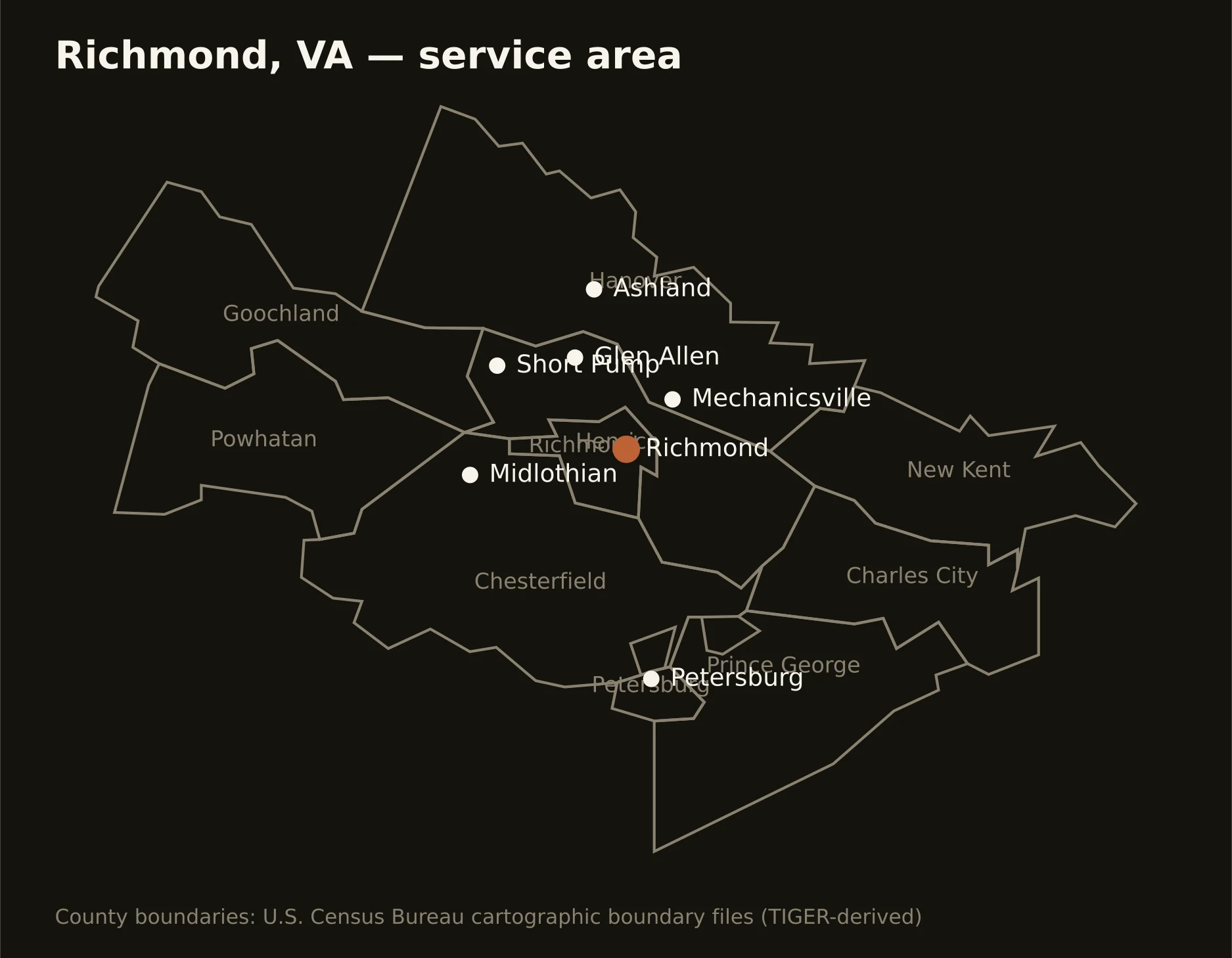
The capital and its ring — Richmond city astride the falls, Henrico and Chesterfield carrying the metro's weight on either bank, Hanover and the western counties on piedmont ground, and the coastal-plain counties running east toward the tidal river. Full county list on the service-area page.